Look at this amazing map:
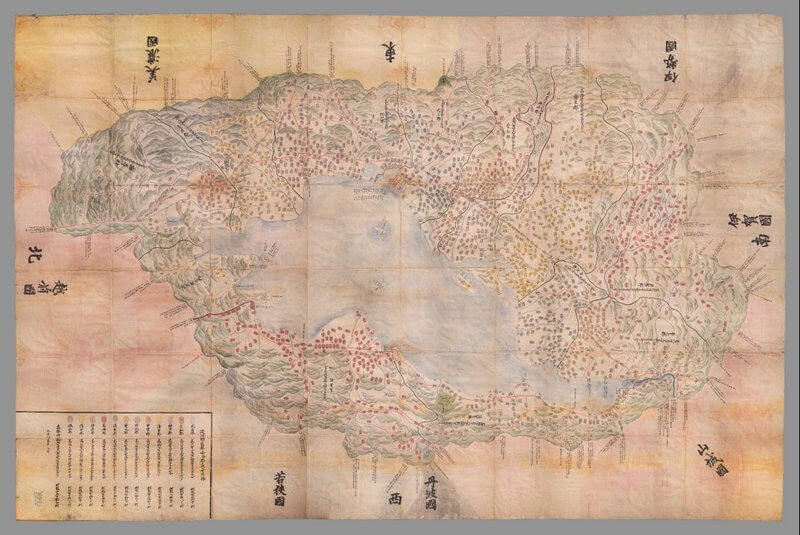
I’m not a Japanese scholar, so I’m not going to have a good explanation of this, but my understanding is that it’s an 1837 version of a 16th-century map of the Ōmi prefecture. It’s part of the map collections at Stanford and it was just recently digitized, in advance of the Primary Source Symposium, where it was the focus of a talk by Kären Wigen. ((As a relevant aside, the symposium was a delightful chance to learn more about a whole lot of stuff I didn’t know much about and to get to know scholars outside my usual early modern books circle, so my thanks to Elaine Treharne and Kathryn Starkey for the invitation.))
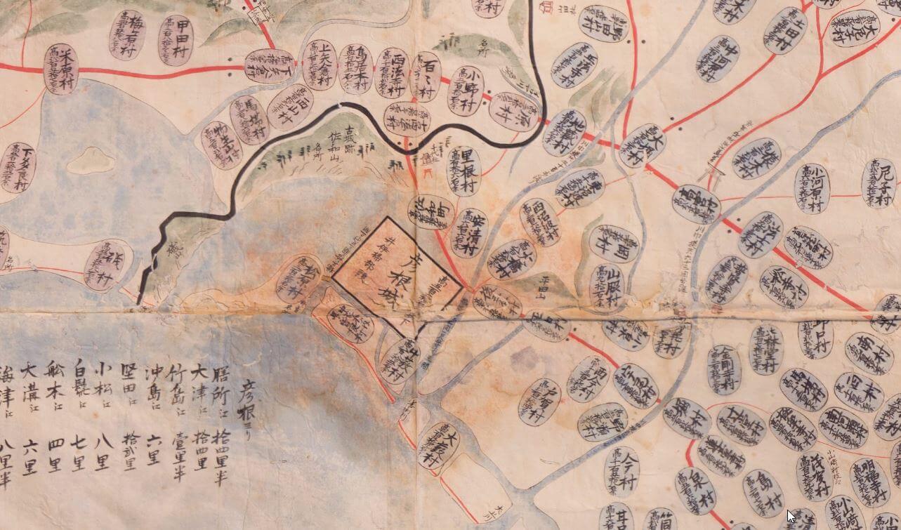
The map is gorgeous, as is its digitization. Look at the texture captured when you zoom in (click on the map to go play with it yourself; it’s a CC BY-NC license, so go ahead and download it and explore):
What the digitization has a hard time capturing, though, is the scale of the thing. It’s huge.
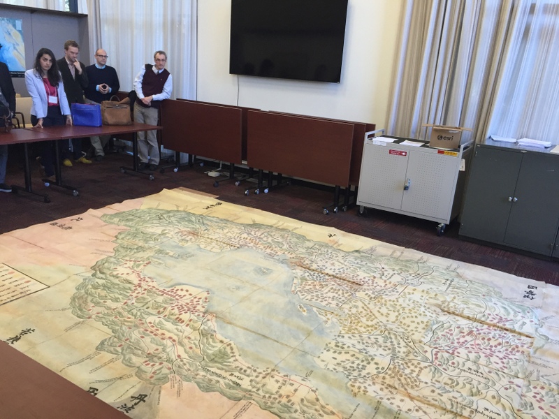
The photo I took of us admiring it (people literally oohed and ahhed when we saw it) gives a slightly better sense of its size— 345 x 504 cm, as the catalog record identifies, or in terms we metric-poor Americans might be more familiar with, almost 11 x 17 feet. At that size, of course, it’s hard to capture the whole thing in one photo. Here’s a photo from Martin Foys taken from the upstairs balcony, that gives another view:
#SPSS2015: 11′ x 17′ 1837 version of 16c. map of Omi, Japan, now digitized: https://t.co/gZZIVTptB4 pic.twitter.com/j0COQ5BI98
— Martin Foys (@martinfoys) November 14, 2015
As I’ve written about before, in reference to books, scale is a hard thing to convey with digitized objects, especially in the platforms libraries usually use to share them. For all that digitization does well—and in this case, it gives us access to details and views we could not otherwise achieve, and I am delighted by that—size is still something confounding. ((And hard to work with: apparently the map was so large that it didn’t fit in the digitization studio, and they had to shoot it in the library rotunda after hours.))